Applications of Montage - Integration into On-Line Data Access Services
Our customers have exploited the capabilities of Montage in generating scientific products, underpinning quality assurance of data products, deploying data access services, analyzing data, and in deriving educational and public outreach products.
IRSA has integrated the Montage components into its archive architecture to provide on-line access to NASA's infrared astronomy datasets. Schlegel, Finkbeiner and Davies (1998) delivered sky maps Zenithal Equal Area projection produced by aggregating the 100 µm observations made with the Diffuse Infrared Background Experiment (DIRBE), aboard the Cosmic Background Explorer (COBE), and with the Infrared Astronomical Satellite (IRAS). IRSA re-projected the map to the Cartesian projection and made it accessible to astronomers through an on-line service (DUST). The map is of particular value to astronomers because 100 µm emission can be used to estimate the extinction by interstellar dust along the line through the Galaxy. The on-line service returns cutouts of the map at requested positions, along with estimates of dust emission, galactic emission and extinction along a line of sight. This service will be extended to form an observation planning service required by the Herschel mission, and will specifically support estimate of dust emission extrapolated from 100 µm to the wavelengths at which Herschel will observe.
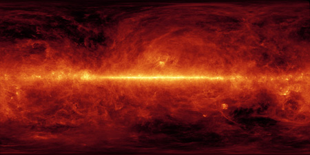
Pseudocolor image constructed from 100 µm data collected from IRAS and COBE.
The IRSA on-demand image cutouts service (Cutouts) returns FITS and JPEG cutouts of all the data sets archived at IRSA. It uses mCoverageCheck to discover the images that lie within the search radius, and mSubimage and mJPEG to create the cutouts.
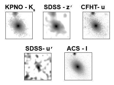
Images generated by Cutouts from the COSMOS data set, including data from KPNO (Ks), SDSS (z'), CFHT (u), SDSS (u'), and HST-ACS (I).
The Montage re-projection engine has also been integrated into IRSA's on-line Finder Chart service. It provides a visualization tool that cross-compares image data sets from three large-area sky surveys: the Two Micron All Sky Survey (2MASS), the First and Second Generation Digitized Sky Survey (DSS), and the Sloan Digital Sky Survey (SDSS). This service enables users to explore a piece of sky taken at different wavelengths and at different times. It uses mRotate to flip the image according to the users specifications, and mShrink to reduce the DSS images to more manageable sizes. The Montage fast re-projection engine (mProjectPP)is used to place images from these surveys on a common set of image parameters, and the computed images are then made into 3-color images. Because the surveys have been made at different times, the images have proven are a powerful discriminator between image artifacts and astronomical sources, and between fast-moving objects and background stars.
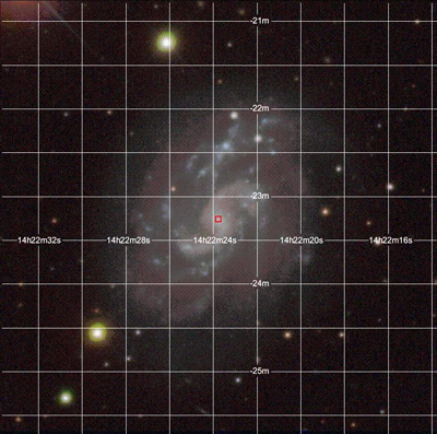
FinderChart composite SDSS image (g, r, and i bands).
The NVO Catalog Coverage Service (QuickStats), hosted by IRSA, returns coverage maps of all catalogs at the NASA Extragalactic Database (NED), IRSA and the Centre du Donnees Astroniques de Strasbourg (CDS) VizieR. It uses mCoverageCheck to determine the overlap between the catalogs and the search area, mCatMap and mAdd to create an image of the point sources, and mJPEG to create images of the coverage maps for visualization.
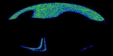
Coverage map showing the all-sky density of sources in the FIRST Survey Catalog, Version 03Apr11 (Becker+2003).
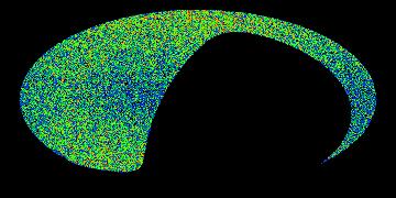
Coverage map showing the all-sky density of sources in the LSPM-North Catalog (Lepine+2005).

